


Ratnapura District Faces Minor Flood Risk Due to Heavy Rainfall

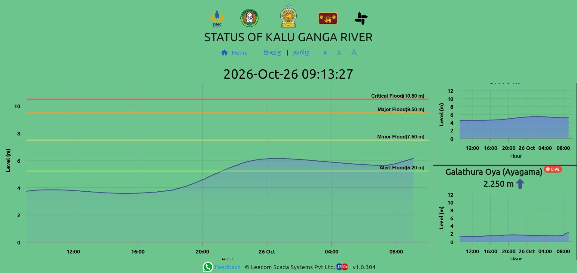
Heavy rainfall experienced in the Ratnapura District since last night (25) and continuing this morning (26), particularly in catchment areas, has raised the risk of minor flooding in the district. Several roads in low-lying areas have already been inundated by floodwaters, according to reports.
Intermittent heavy rainfall continues in the catchment areas of the Kalu Ganga and its tributaries, while the skies remain heavily overcast. According to the weather forecast issued by the Department of Meteorology, rainfall exceeding 100 mm is expected in some areas of Sabaragamuwa Province today (26). The water level of the Kalu Ganga, measured at the water gauge installed at Muwagama, Ratnapura, stood at 6.15 metres as of 9:10 a.m. on 20 October 2026. This is approaching the 7.50-metre level at which a minor flood situation is considered to occur.
Accordingly, Mr. M.G. Lalith Ananda, Ratnapura District Secretary / Government Agent and Chairman of the District Disaster Management Committee, requests the public living along the Kalu Ganga and its tributaries, as well as those residing in low-lying areas, to remain highly vigilant in view of the prevailing situation.
The public is kindly requested to visit www.rivernet.lk to monitor the water levels of the Kalu Ganga and its six tributaries, namely, the We Ganga, Denawaka Ganga, Niriella Ganga, Kuru Ganga, Galathura Oya and Kukule Ganga, in real time.
According to the water level readings at the Muwagama water gauge in Ratnapura, the alert level of the Kalu Ganga is 5.2 metres. A minor flood situation is indicated when the water level reaches 7.5 metres, a major flood situation at 9.5 metres, and a critical flood situation at 10.5 metres.
District Media Unit,
District Secretariat / Department of Government Information,
Ratnapura.